Curaçao Hones Its Master Planning Approach


The development of ports requires a long-term vision that incorporates an integral approach across sectors, taking a dynamic environment into account. Curaçao Ports Authority (CPA) understands this first-hand – as well as the importance of master planning in ports’ future goals – as they have been involved in upgrading the Curaçao Port Masterplan and the focused ones to better reflect Curaçao ports’ anticipated growth. CPA assumes the responsibility to manage safe and efficient movement of vessels within the ports, and is also responsible for continued development of the different port sectors. A systematic approach, as depicted in Figure 1 below, is applied when selecting new operators and/or investors at CPA properties for which a specific zoning is designated.
When tackling the masterplan for the Curaçao ports, the spatial development options were analyzed based on a set of assumptions and possible future scenarios. This analysis formed the basis for formulating a strategic vision for the ports. It was an iterative process that resulted in a robust and integral Curaçao Port Masterplan. Specific industry sectors are almost always assigned to specific port zones, or clusters, which in turn may require separate focused masterplans.
These focused masterplans were developed with the input of a vast array of stakeholders. Two of these plans currently in implementation are the Rif area cruise terminal masterplan and the masterplan for repurposing the port waterfronts in Willemstad.
Curaçao Port Masterplan
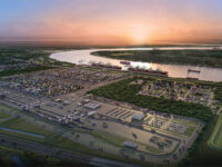
It is expected that the right landside development for the port industrial complex of Curaçao will trigger increased maritime activities. As such, the vision seeks to enhance the current landscape, in order to establish a commercial profile of the port as a strong industrial gateway hub with a growing transshipment sector as illustrated below in Figure 2. This can be achieved through continued landside developments that positively contribute to the gateway function of the port (cruise, storage, distribution etc.) while maintaining the current industrial activities and fortifying the industrial segment with new developments in areas with an industrial designation (LNG, expansion ship repair, crude/fuel refining etc.) and additionally exploring opportunities to leverage transshipment activities in particular relating to dry bulk cargo (in addition to existing liquid bulk).

The evolution of ports is influenced by many stakeholders and this becomes more apparent in an island economy where roles often overlap. Therefore, the first order of business to tackle long-term strategic decisions within the Curaçao ports was for CPA to align with the larger landlords and jointly commission the Port of Rotterdam to assist in developing a masterplan for the ports of Curaçao.

The Curaçao Ports Masterplan (2021) carried by the main stakeholders in the port details scenario forecasts and spatial development options that form the basis for a clear mission, vision and strategy for the future development of the ports. The masterplan serves as guidance in the strategic, decisionmaking process when assessing the regional market demands and available properties (Figure 3). Effectuating the principles set forth in the masterplan, CPA engages in further collaboration with key port stakeholders in order to deduce from the masterplan specific roadmaps and commercial plans in preparation of the implementation of the agreed vision.

The Rif Seaport Masterplan
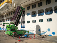
In 2014, CPA setup a masterplan to further develop the cruise terminal in the Rif area to accommodate the expected growth in the cruise sector (Figure 4). The implementation entailed a two-phased approach: maritime side development and landside development. The maritime side plans were implemented in 2017 with the completion of the USD 42M Second Mega Cruise Ship Pier and upgrading of the First Mega Cruise Ship Pier thereby expanding the island’s ability to welcome more frequent calls by larger cruise vessels. The new Tula pier is capable of handling the largest cruise vessels in the world including the Oasis class of vessels.
The second phase of the project will entail additional landside developments including new terminal facilities that will support more inter-porting, improved linkages, from well-functioning ground transportation zones and expanded pedestrian plazas and sidewalks, to the entirety of the Curaçao destination offering. The area will tie in with surrounding developments and will be enhanced with the adjacent eco “mangrove” park. Ultimately, the Rif area will play a pivotal role in connecting the new developments and the existing downtown landmarks. Due to the impact the COVID pandemic has had on the cruise industry, this second phase of the project is expected to be completed in 2024.

Repurposing the Waterfronts in Willemstad
Always with the mission in mind of putting the waterfront to work for the social and economic benefit of the Island, CPA prepared a masterplan to serve as an actionable strategic document guiding the realignment of waterfront assets along Sint Annabaai (Figure 5). The plan was the result of a series of interactions with stakeholders holding roles throughout the community, downtown merchants and the general public.
Increased vessel size and cargo containerization has reduced the inherent value of the berths and sheds along Sint Annabaai that once welcomed this traffic.
The commercial maritime role these properties used to fulfill resulted in a pattern land use common in waterfronts worldwide; communities and neighborhoods developed away and disconnected from the water’s edge, with transportation linkages and a belt of warehouses, industrial uses, marshaling and storage yards, gates and fences filling the gap between the water’s edge and balance of the community. Renewal of portions of the Sint Annabaai waterfront hold promise to reverse this traditional arrangement, opening downtown districts directly onto the water’s edge.

Four guiding principles were established to help guide the generation of plan options:
- Increase connectivity and public access to the waterfront to the greatest extent possible.
- Support the related goals of nurturing continued revitalization of Willemstad and increasing residential and visitor populations in the downtown core.
- Promote the island’s uniqueness and culture along the waterfront.
- Engage properties along the inner harbor to support economic and job growth.
The implementation of the masterplan commenced in 2020 with the development of the luxury apartment project THE WHARF (www.thewharfcuracao.com, Figure 6) at the Scharloo wharfs. This first project will extend the fabric and vibe of Scharloo and Punda to the water’s edge. As per the masterplan, the vision calls for streets from the surrounding neighborhood to extend into the project area, creating space for a sequence of apartment blocks along a new waterfront esplanade. The entirety of the district is linked by new parks and pedestrian ways for the entire public to enjoy. The waterside fronts will once again be open to the public.
It is our approach to incorporate uncertainty and flexibility considerations in all of the port masterplans. The last few years have underlined how fast the global trade and the respective operating environment can change. It is precisely because change is to be expected that we value the importance of the process inherent in setting up these masterplans. The strategic decisions that flow out of the masterplans are the result of a dynamic process that is well delineated in each of the plans. By periodically aligning the plans, we can adjust the forecasts and follow the process delineated in the masterplans to adopt new development strategies when necessary.